 ar
ar bg
bg hr
hr cs
cs da
da nl
nl fi
fi fr
fr de
de el
el hi
hi it
it ko
ko no
no pl
pl pt
pt ro
ro ru
ru es
es sv
sv tl
tl iw
iw id
id lv
lv lt
lt sr
sr sk
sk sl
sl uk
uk vi
vi et
et hu
hu th
th tr
tr fa
fa ms
ms hy
hy ka
ka ur
ur bn
bn mn
mn ta
ta kk
kk uz
uz ku
ku
GNSS
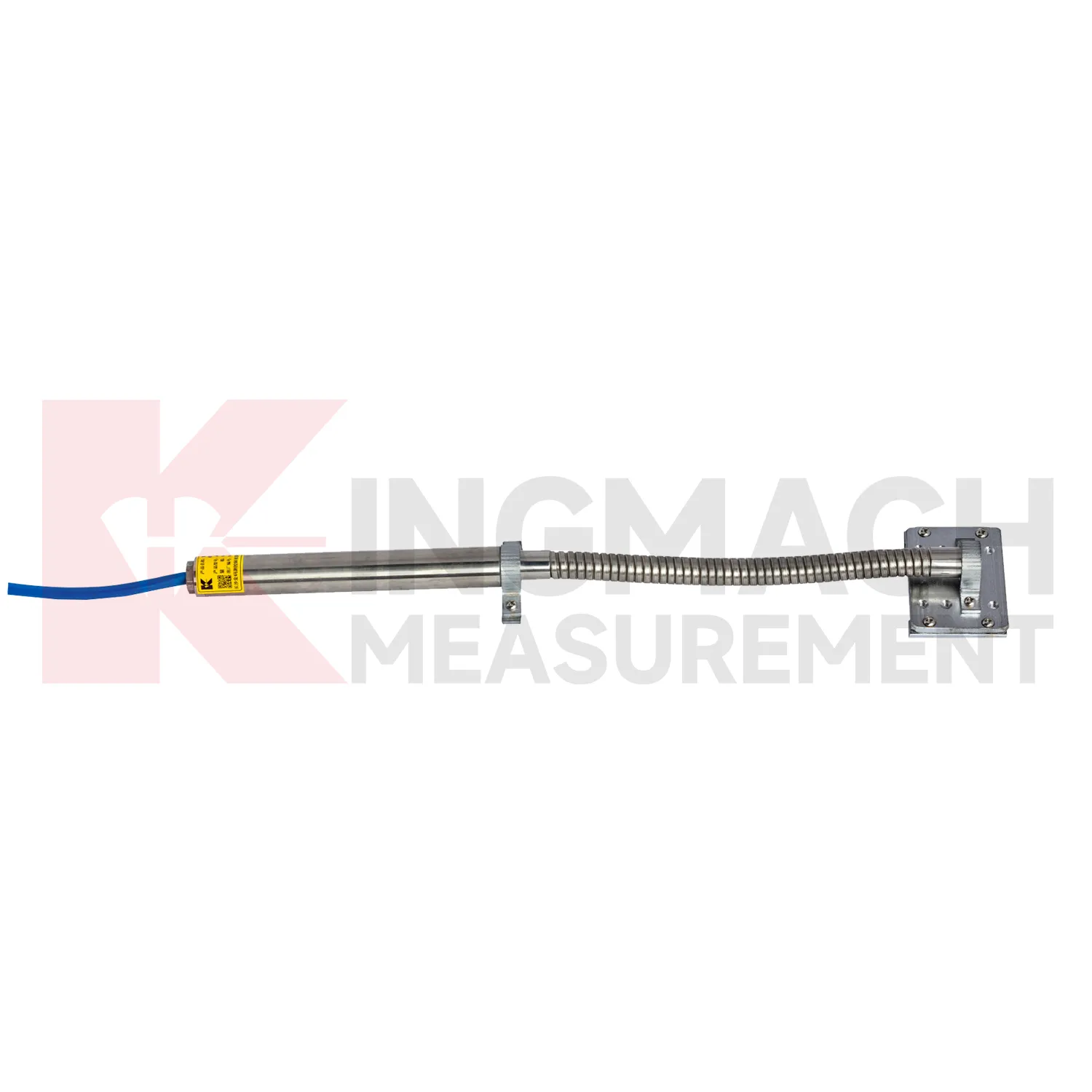
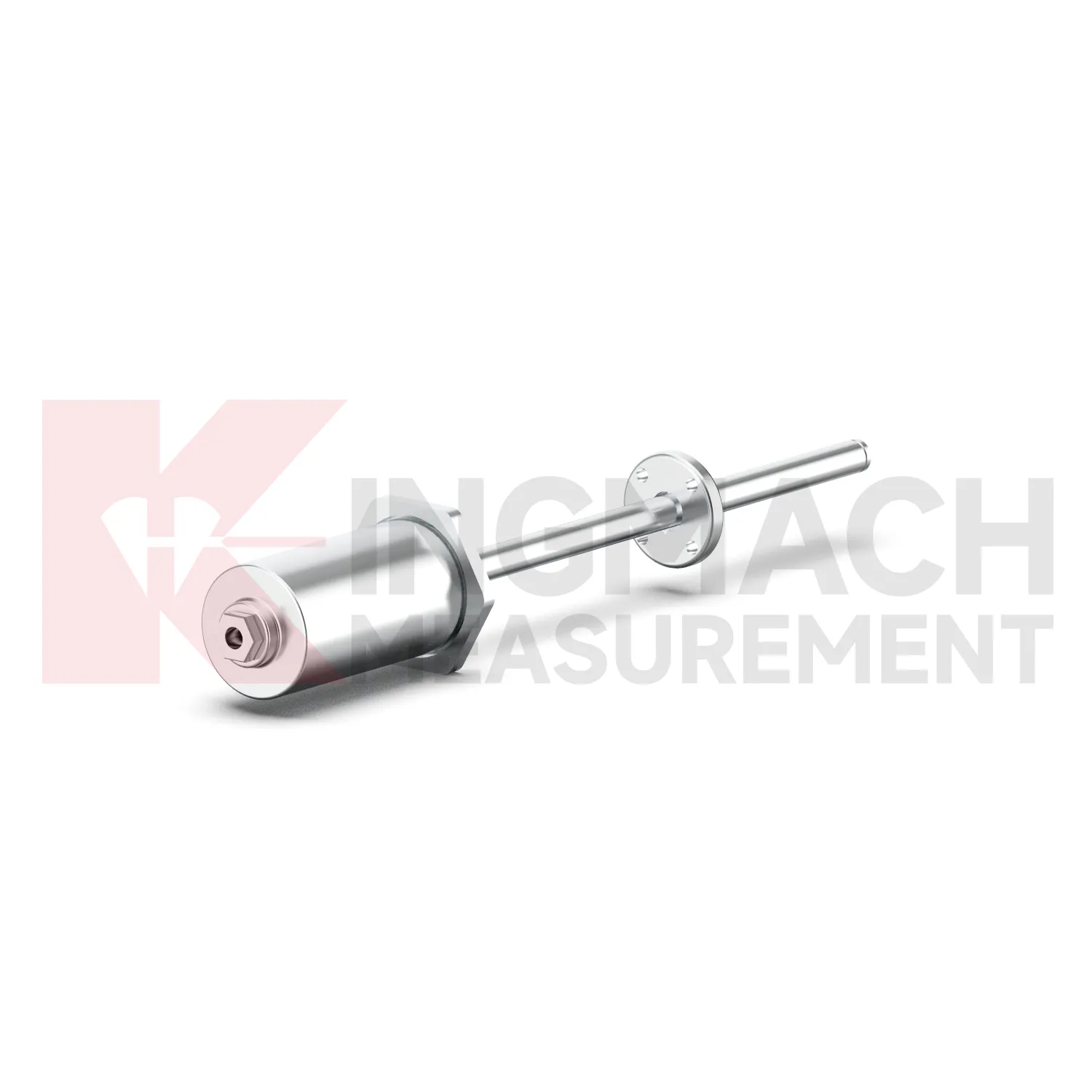
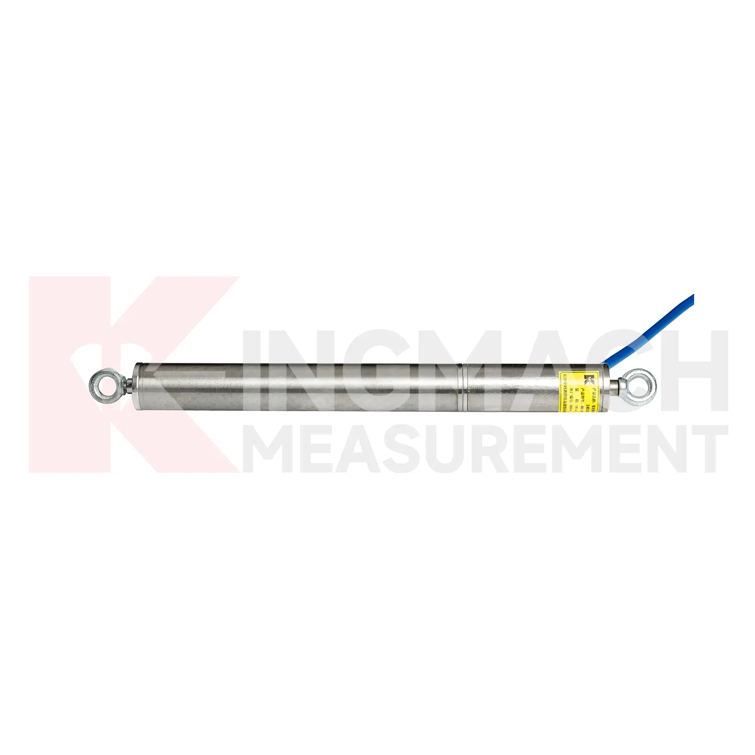
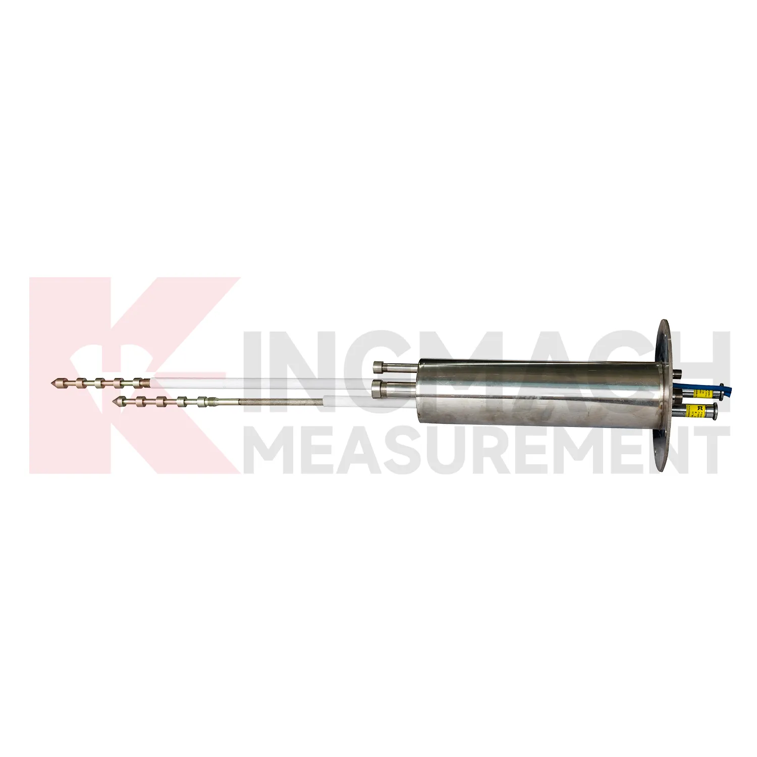
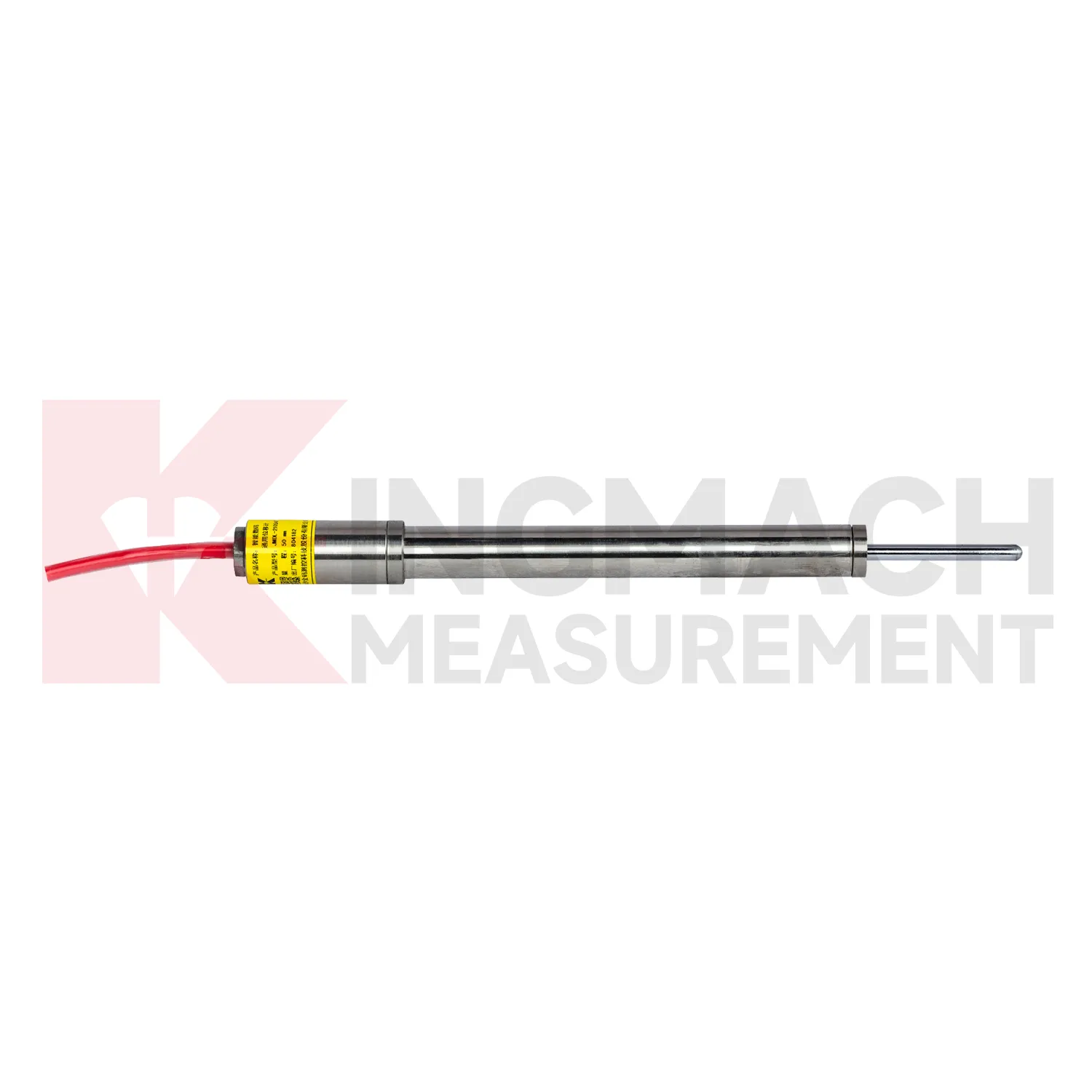
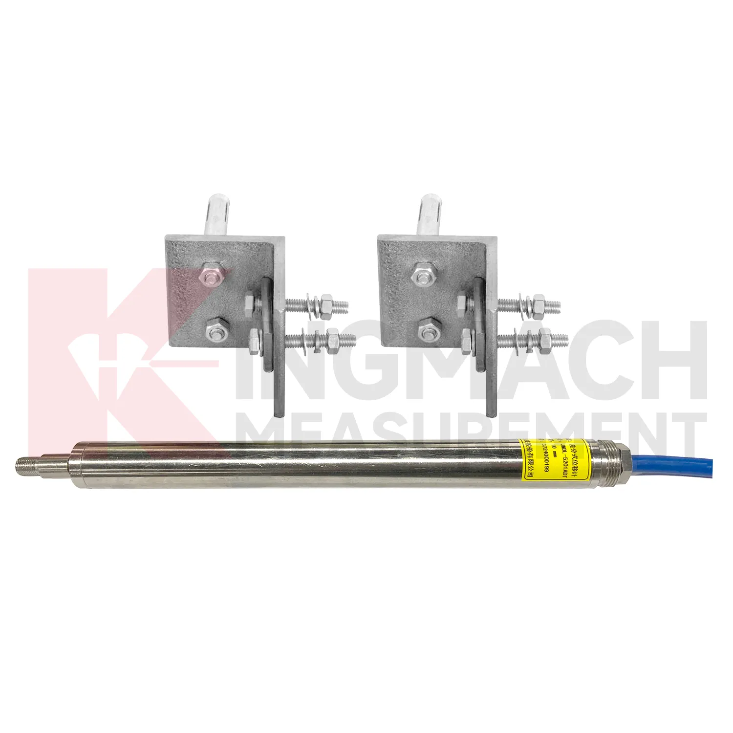
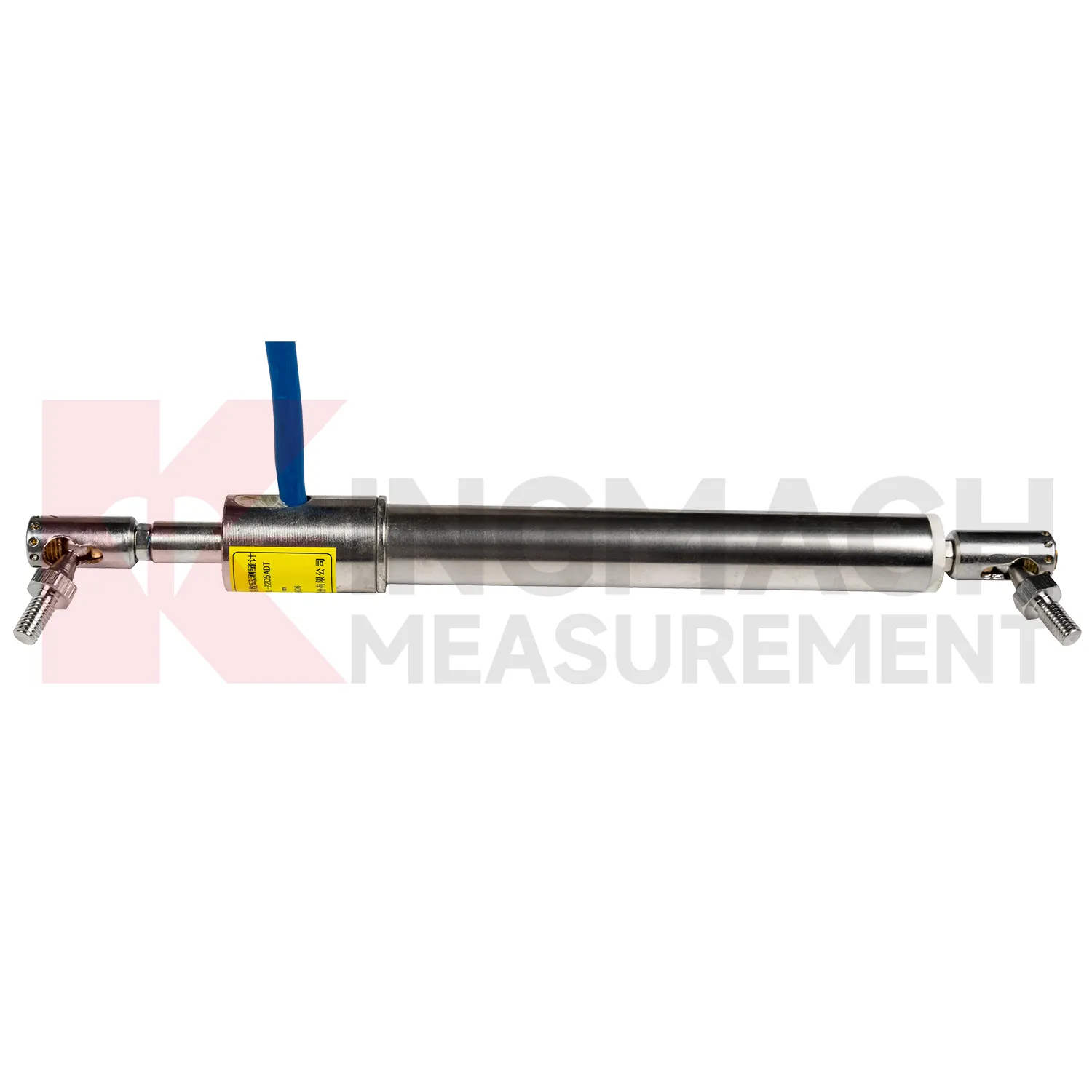
Kingmach GNSS include the JMDL-31XXAT Smart Multipoint Displacement Meter for tunnels, rock slopes, foundation pits, and surrounding rock layers. This product is not used like a surface joint gauge. It is built for boreholes where movement must be separated by depth. The instrument group includes displacement gauges, PVC measuring rod protective tubes, anchor heads, and multipoint installation kits that support three to five points. During installation, the borehole is prepared, anchor heads are set at selected layers, and grouting fixes each anchor to its target rock or soil zone. Listed models include 50 mm, 100 mm, and 200 mm ranges, all with 0.01 mm resolution. The sensing circuit changes output frequency as the measuring rod moves through the coil, so each channel can report how one anchored layer moves relative to the reference head. This layout is useful when tunnel crown movement, slope slip, or foundation pit deformation may start at one depth before it appears elsewhere. Field records should emphasize borehole number, anchor depth, grout condition, channel order, and the direction of expected movement. During later review, engineers can compare shallow and deep anchors to judge whether the deformation is local relaxation, progressive sliding, or full-section movement. That layered view is the main reason to use a multipoint instrument instead of several unrelated surface gauges.
Application of GNSS
In integrated structural health monitoring, GNSS act as the movement layer inside a wider measurement network. Their role is to show where a point has shifted, how fast the shift is developing, and whether the change agrees with other instruments. Kingmach displacement products can feed digital records into acquisition units and monitoring platforms, while related Kingmach product groups provide strain, load, settlement, tilt, vibration, pore pressure, water level, rainfall, data logging, cables, and software. A practical system may use JMDL-52XXADT meters for precise joint travel, JMDL-31XXAT meters for rock layers, JMDL-24XXAT meters for buried geogrid deformation, and JMLS-22XXADT sensors for longer cable travel. The data chain should define point names, units, zero values, sampling intervals, warning grades, and inspection actions before alarms are enabled. This prevents a displacement curve from becoming an isolated chart. Instead, the reading can be checked beside force, strain, settlement, temperature, rainfall, and construction records, giving engineers a clearer basis for maintenance and warning review. During commissioning, each curve should be verified against the physical point so later reports can be trusted by site teams, designers, and owners. The same record should also note cabinet number, logger channel, cable tag, power supply, and communication route, because many long-term data problems begin outside the sensor body.
The future of GNSS
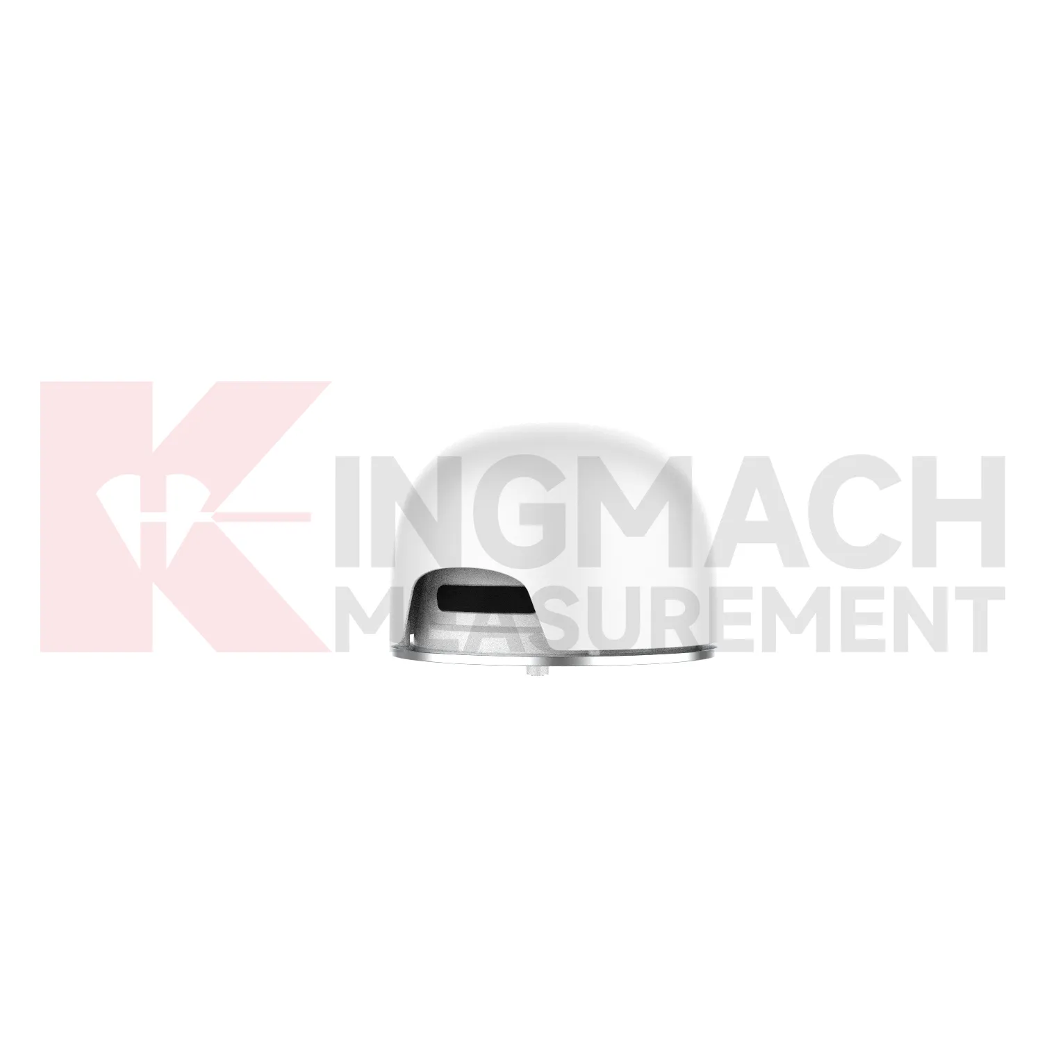
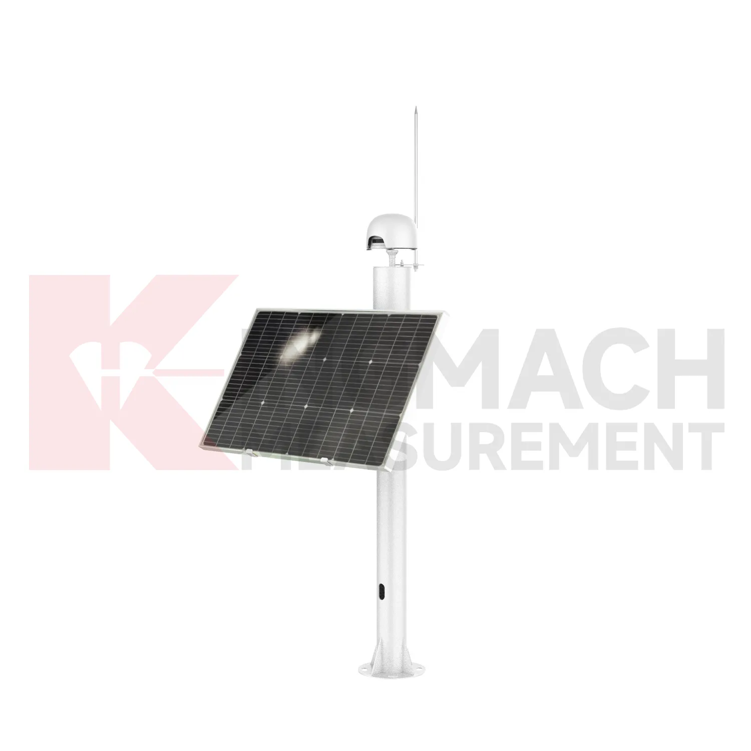
Wireless and low-power networks will change how GNSS are deployed on difficult sites. Many displacement points are located on slopes, dam shoulders, tunnel portals, remote rail subgrades, or temporary construction zones where cabling is expensive and easy to damage. Kingmach displacement products already support automatic acquisition in several forms, and future field layouts can combine wired RS485 points, LoRa or 4G gateways, solar power, and compact edge devices. The engineering task will be to preserve reliable baselines while reducing field maintenance. Sensors with built-in memory and stored calibration data help because the point can retain key identity information even when a gateway is replaced. Remote power planning, connector sealing, lightning protection, and clear channel naming will become as important as the sensor range itself. For remote terrain, the biggest gain will be fewer unnecessary site visits: teams can review battery status, data gaps, and movement direction before sending technicians into a hazardous or hard-to-access location.
Care & Maintenance of GNSS
For magnetostrictive GNSS, maintenance should protect the non-contact sensing advantage by keeping wiring, power, and mounting clean. Kingmach JMCW-21XXADT lists DC24V input, RS485 communication, IP67 protection, reverse polarity protection up to -36V, and wiring colors for power and RS485 lines. Confirm red, yellow, blue, and green wires before energizing the device, and check grounding in cabinets where motors, pumps, or hydraulic equipment may create electrical noise. Because the sensor is used for absolute position measurement over 0 to 1000 mm, inspect mechanical alignment and travel stops so the moving part remains within range. Do not clamp the sensing body in a way that transfers bending force from the machine frame. During service, compare repeatability at known positions and review whether position drift appears after temperature swings, maintenance work, or hydraulic cylinder repair. Keep the installation photo, point number, zero value, and expected movement direction with the commissioning record for later review. If a reading changes after maintenance work, inspect the base, anchor, cable, and cabinet before assuming the structure itself has moved.
Kingmach GNSS
GNSS are used when a structure needs movement data that can be reviewed, compared, and acted on before deformation becomes visible. Kingmach covers short range crack movement, expansion joint travel, rock layer displacement, geogrid deformation, draw-wire movement, and long stroke position tracking. The category includes JMDL-21XXAT general-purpose displacement meters, JMDL-22XXAT crack gauges, JMDL-24XXAT flexible meters, JMDL-31XXAT multipoint meters, JMDL-32XXAT bedrock meters, JMDL-49XXAT formwork meters, JMDL-52XXADT differential meters, JMCW-21XXADT magnetostrictive meters, and JMLS-22XXADT wire rope sensors. On site, this means one product group can cover bridge joints, tunnel portals, slope movement, dam deformation, railway subgrade settlement, and industrial linear motion. The value is not only the displayed millimeter reading. It is the ability to connect movement, time, temperature, construction activity, and warning limits into one record. The point should be named on the drawing, linked with its cable route, and checked against the expected movement direction before the first automatic reading is accepted. For daily review, the reading should be compared with nearby points, recent weather, site operations, and any loading event that could explain the movement.
FAQ
Q: Which GNSS are used for rock layers or bedrock?
A: JMDL-31XXAT multipoint meters are used for different surrounding rock layers, while JMDL-32XXAT single-point bedrock meters are used for tunnel rock mass, dam bedrock, slope, or foundation pit movement.
Q: How many points can the multipoint meter support?
A: The multipoint installation kit supports three to five monitoring points, with anchor heads fixed at different depths by drilling and grouting.
Q: What ranges are listed for these models?
A: Both JMDL-31XXAT and JMDL-32XXAT list 50 mm, 100 mm, and 200 mm models with 0.01 mm resolution.
Q: Why monitor several depths?
A: Different layers may move differently. Separating shallow and deep movement helps engineers judge whether the problem is surface creep, deeper rock slip, or overall mass movement.
Q: What records should be kept?
A: Keep drilling depth, anchor location, grouting date, channel name, zero value, cable route, and first stable reading.
Reviews
Joshua Clark
We ordered a full monitoring solution including sensors and data loggers. Everything works seamlessly together. Great supplier!
Robert Taylor
The weir flow meter is well-built and delivers accurate measurements. Great value for water management applications.
Latest Inquiries
To protect the privacy of our buyers, only public service email domains like Gmail, Yahoo, and MSN will be displayed. Additionally, only a limited portion of the inquiry content will be shown.
Amelia***@gmail.comSingapore
Hello, I am looking for visualization software for monitoring system data analysis. Please let me kn...
Isabella***@gmail.comGermany
Hello, we are evaluating weir flow meters for a water management project. Please share accuracy deta...
Related product categories
- crack monitoring gauges
- displacement crack gauge
- displacement sensor
- laser displacement sensor
- displacement sensors
- linear displacement sensor
- optical displacement sensor
- wireless displacement sensor
- laser displacement sensors
- non contact displacement sensor
- cable displacement sensor
- draw wire displacement sensor